History all around you
The Chase Through Time Project is a partnership between Staffordshire County Council, Historic England and the Heritage Lottery Fund.
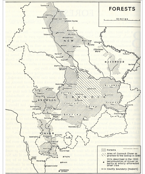
It is a historic landscape survey and research project to unravel over 2000 years of man’s activity across Cannock Chase. The project area covers the whole of the Cannock Chase, some 26 square miles of rural landscape designated as an Area of Outstanding Natural Beauty, a rich landscape, of biodiversity and historic character.
The Area of Outstanding Natural Beauty has many other designations and parts are protected as a Special Area of Conservation (SAC), Site of Special Scientific interest (SSSI), Conservation Areas, Scheduled Monuments, Registered Parkland and Listed Buildings.
Little is known of the early history of the Chase, and therefore we are yet to fully understand the changes that have taken place across the generations.
Learning about how our ancestors managed and worked their environment may provide valuable clues to its future management and conservation, for example questions like when and where were animals grazed upon it?
The project started in mid 2016 and continues to early 2018.
The view from above
From the late 19th century humans have known of the benefits of observing landscapes from the air. Floating high in balloons over sites like the Giza Plateau in Egypt, in 1904 archaeologists began to appreciate the connections between monuments as well as identifying new sites hitherto unseen from the ground.
At the outset of the Great War, the primary job of military aviators was to act as gatherers of intelligence and as spotters for artillery units and, using small cameras they were able to record events on the ground with increasing levels of detail. This experience was not lost on innovators such as O. G. S. Crawford who served with the Royal Flying Corps during the war. In 1920 Crawford was appointed as the Ordnance Survey’s first Archaeological Officer where he became increasingly interested in the use of aerial photographs to identify and survey archaeological sites. Importantly Crawford tested many of his aerial discoveries through excavation and was able to prove the value of aerial reconnaissance in the field of archaeology. Nearly 100 years since O.G.S Crawford joined the Ordnance Survey, the technology has changed but archaeologists still rely on aerial photographic survey to identify sites and landscapes of archaeological interest.
Today, lidar and other forms of remote sensing offer more ways to identify, record and to an extent understand our cultural heritage. Working with Historic England specialists, it is LiDAR (Light Direction and Ranging) combined with aerial photographic survey that has helped us to understand the development of the Cannock Chase through time.
Historic England specialists have been able to use the LiDAR and aerial photography to map a range of archaeological features across the Chase dating from prehistory onwards. Such features included the full extent of First World War remains, evidence of prehistoric activity, extensive medieval and later coal mining and post-medieval land divisions associated with the management of the chase were recorded.
The results of Historic Englands mapping and research are now available to view online:
- To create a mobile-based application to be available on a range of Smart Phone devices which will tell stories through a blend of text, visuals and audio of the Cannock Chase AONB centred upon the development of the Chase landscape and its role during the Great War.
- Develop a story to showcase aspects of the military history of the Chase (e.g. the story of a fictitious soldier as he visits different parts of the Great War camps).
- To draw in the surviving (and visible) archaeology of Cannock Chases Great War heritage into the story.
- These stories will link into one or more existing walk routes on Cannock Chase. Where this is not possible, new routes will be devised and agreed in advance with Natural England and the Area of Outstanding Natural Beauty (AONB).
- To tell the story of the development of Cannock Chase’s landscape between 1600 and 1970 in a series of images which use current views coupled with historic images. This will be supported by text and documentary evidence to showcase the historic management of the Chase.
- Work with the Chase through Time Landscape Research Group and colleagues from the Friends of Cannock Chase to develop a series of augmented reality images (approximately 10) to correspond with aspects of the overall story. These views would use current and historic photographs and postcards to show the landscape as it was and as it is now.
- To create a stable and fully accessible mobile app this can be easily maintained by staff and expanded at a later date.
- The two stories will inevitably link together and it is intended that the AONB’s ecological habitats will be introduced into the developing narratives where possible.
Launching the app
- The App will be tested and launched during 2017.
- It has been led by a specialist consultant to develop the ‘windows on the past’ app.
Remembering the Chase
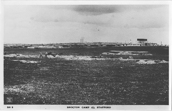
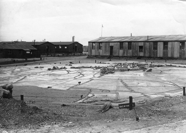
The Camps
The dominions of Cannock Chase
Victory on Messines Ridge 1917
The Event: June 2017
Testing the Chase
TRAINING AND WORKSHOPS
Historic research
LANDSCAPE RESEARCH 1600 TO 1970